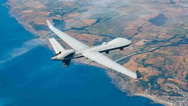
The geospatial data sector has also seen a similar trajectory as drones, and often goes hand in hand with the latter.
Drone laws in India have a rather colourful past. Up until August 2021, the regime was restrictive and compliance-heavy. The Drone Rules, 2021 demonstrated a significant shift in the regulatory approach towards drones where compliances were simplified and many restrictions were done away with. BVLOS (beyond visual line of sight) operations and carriage of payload were made permissible – two aspects of drone operations which are critical for their widespread adoption. Restrictions on foreign operators from establishing presence in India were also done away with, opening up important avenues for inflow of investments.
Since then, the Government has emphasised on ease of doing business and strongly encouraging make in India. Resultantly, in February 2022, import of completely built up and knocked down drones was banned for most civil use cases, although import of drone components was expressly permitted. The move was to ensure that manufacturing took place in India whether it was through technological collaborations or through the FDI route. The import ban received a mixed response, with domestic drone manufacturers lauding and welcoming the move but importers who were selling foreign drones in India condemning it.
The Government has been firing from all cylinders when it comes to regulatory and policy initiatives. Standard operating procedures were prepared for sector-specific applications, in addition to production-linked incentive schemes for manufacturers. Various state governments have also permitted drone operations to be conducted on a “proof of concept” basis, including for vaccine deliveries and mine inspection, providing a much-needed boost to the industry, especially for novel use cases. More recently, in June 2023 the Government has also eased the permissions required for export of civil use drones, which should benefit local manufacturers.
Even on the demand side, the Government is itself a significant buyer in the Indian drone market – with domestic defence procurements alone being estimated at well more than INR 3 billion for more than 2,000 drones in the last couple of years. Many other government agencies, PSUs and public private partnerships at the Central and State level are also procuring drones, especially for the infrastructure sector. The recent public listing of (and demand for shares of) drone companies is further proof of the growth story of drone businesses in India, and also the upcoming opportunities in this sector.
The geospatial data sector has also seen a similar trajectory as drones, and often goes hand in hand with the latter. Prior to February 2021, geospatial data regulations involved an endless maze of prohibitions, conditions and approval requirements. The Department of Science and Technology, through its guidelines, changed this all and significantly liberalised the sector. “What is readily available globally does not need to be regulated”, is the message in the preamble of the guidelines. The guidelines expressly state that there is no requirement for prior approval, security clearance, license or any other restrictions on the collection, usage, storage, or publication of map data, unless stated otherwise. Of course, certain restrictions continue to apply on foreign entities, as well as Indian subsidiaries of foreign entities, when it comes to highly accurate map data and surveying activities. Export of geospatial data is largely permitted except data sets of accuracies beyond prescribed thresholds. Moreover, there are restrictions around collection, ownership and usage of highly accurate map data for entities which are not Indian-owned and controlled. Therefore, businesses need to be mindful of the conditions which apply to such data sets, not only for their own activities but also for data providers and other vendors.
The regulatory and policy reforms in these sectors are bound to act as catalysts for existing technologies to proliferate and for more cutting-edge technologies to be developed. For instance, permitting BVLOS operations and carriage of payload for drones enables not only express deliveries of emergency supplies (say medicines or donated organs) but also surveying of dangerous areas (such as transmission lines, mines and factories).Similarly, the free collection and usage of geospatial data acts as an enabler for dozens of industries, right from logistics and real estate to disaster response and automobiles. The National Geospatial Policy, 2022 also envisages a significant role of private entities in collaborating with the Government for creation and making available of high-quality map data. Similar to the drones sector, the geospatial data sector is also ripe with opportunities for investments, especially given the Government’s continued efforts to encourage the proliferation of businesses in both these sectors.
https://www.financialexpress.com/business/defence-drones-and-maps-unleashed-how-the-government-is-fostering-growth-and-investment-in-these-sectors-3215810/


